User Interface & Screen Guide
Geotify features a Jetpack Compose Material Design 3 interface with dynamic navigation, interactive map controls, and an independent dual-theme system.
Core Screens
App navigation consists of three primary screens managed by GeotifyNavHost:
Reminders Screen
File: RemindersScreen.kt
Central hub for managing geofenced alerts.
- Reminders List: Shows active and inactive reminders grouped by status, displaying arrival/departure badges, target location aliases, and range status (is_in_range).
- Interactive Map View: Displays active geofences on OpenStreetMap with color-coded radius overlays.
| List View | Map View |
|---|---|
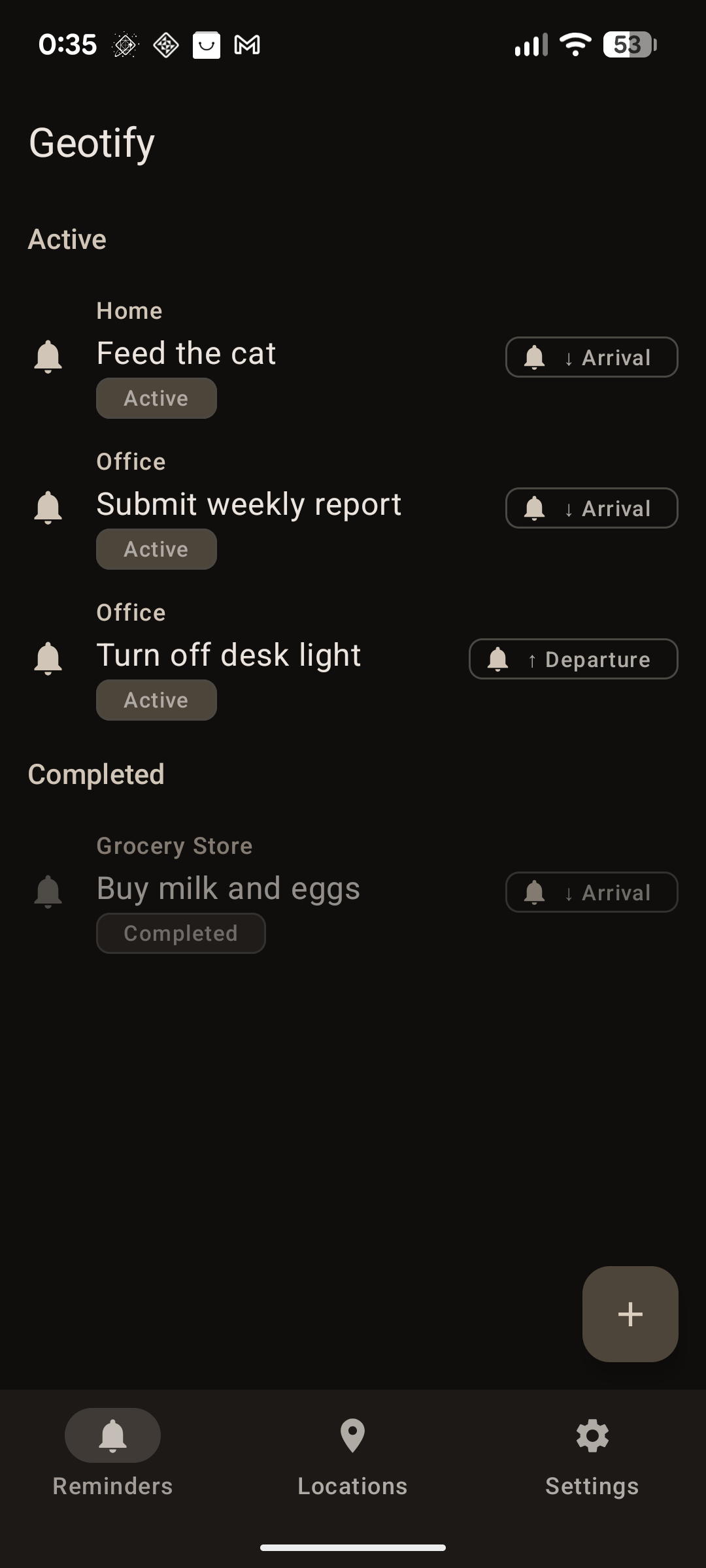 Active reminders list. |
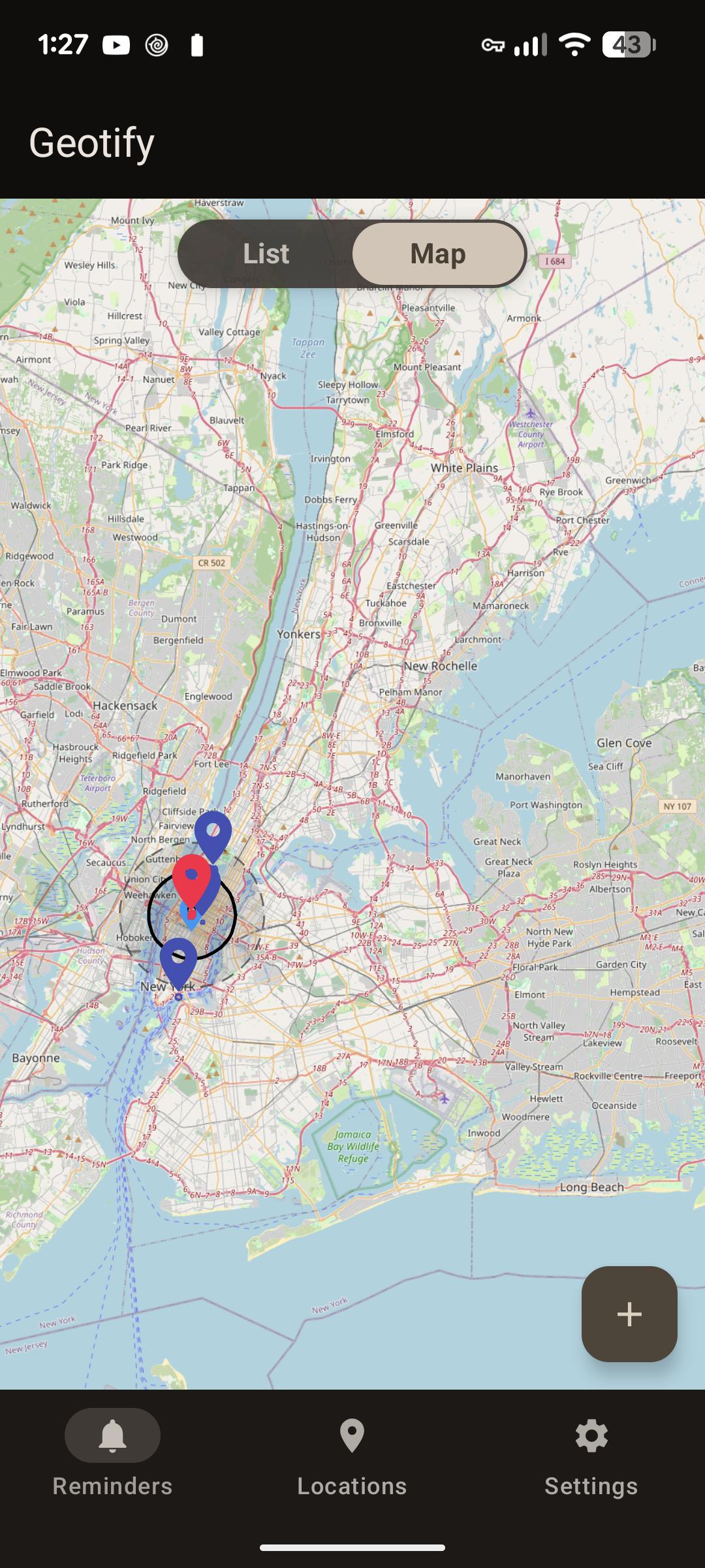 Geofence radius overlays on map. |
Locations Screen
File: LocationsScreen.kt
Manages saved Points of Interest (POIs). - Saved Locations List: Shows configured POIs, GPS coordinates, geofence radii, and linked active reminder counts. - Location Picker Dialog: Interactive map dialog allowing coordinate selection by tapping or capturing current GPS location. - Alias Validation: Enforces unique location names (case-insensitive) for AI AppFunctions integration.
| Saved Locations List | Map Picker View |
|---|---|
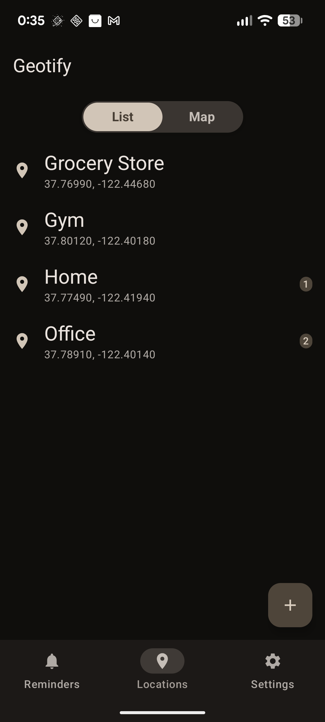 Saved location points. |
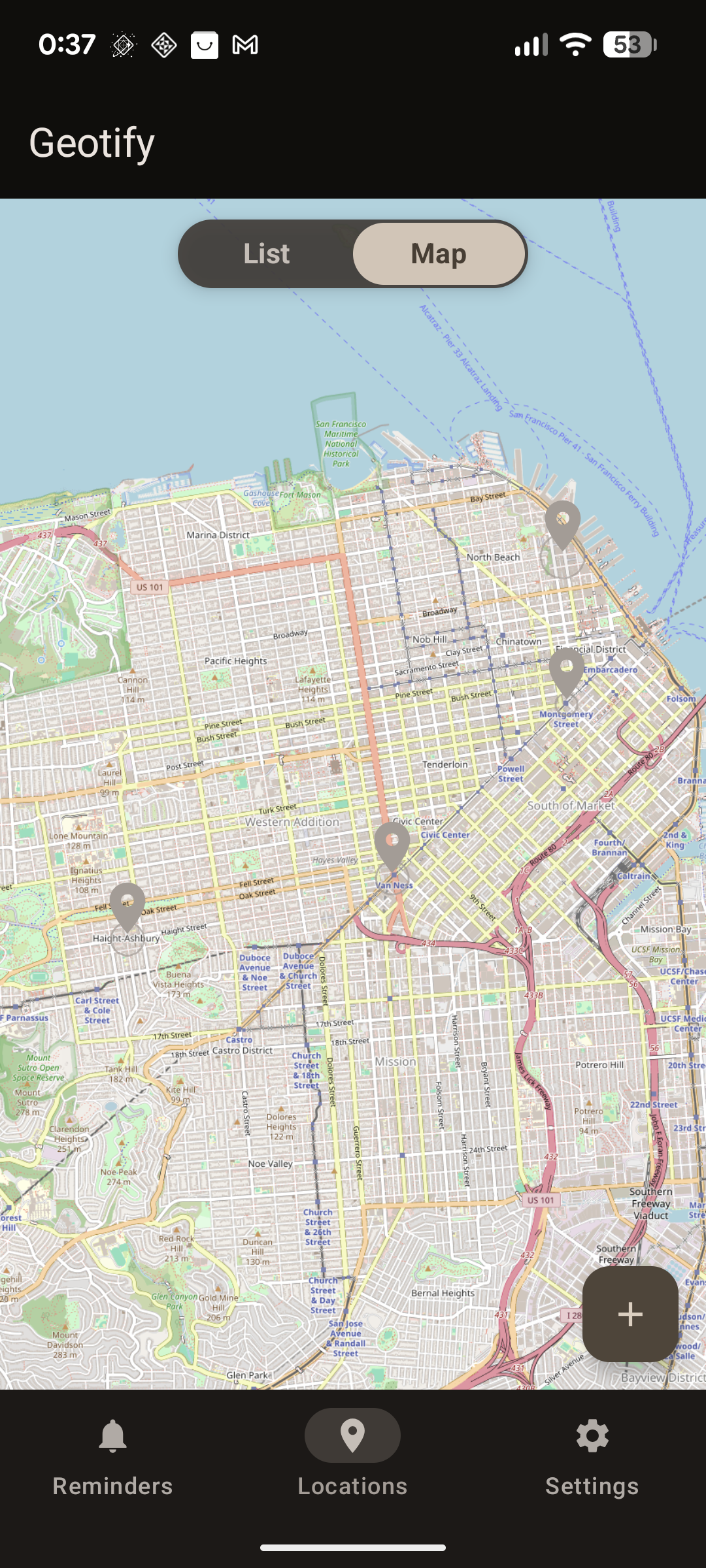 Interactive location picker pin. |
Settings Screen
File: SettingsScreen.kt
Exposes parameters for fine-tuning geofencing behavior and visual themes.
- Theme Controls: Independent application UI theme and map tile layer theme selectors (SYSTEM, LIGHT, DARK).
- Geofence Radii: Configurable Outer Radius N (km) and Inner Radius r (km) for the sliding window algorithm.
- Responsiveness: Adjustable location cache timeouts and recalculation debounce delays.
| Settings Screen |
|---|
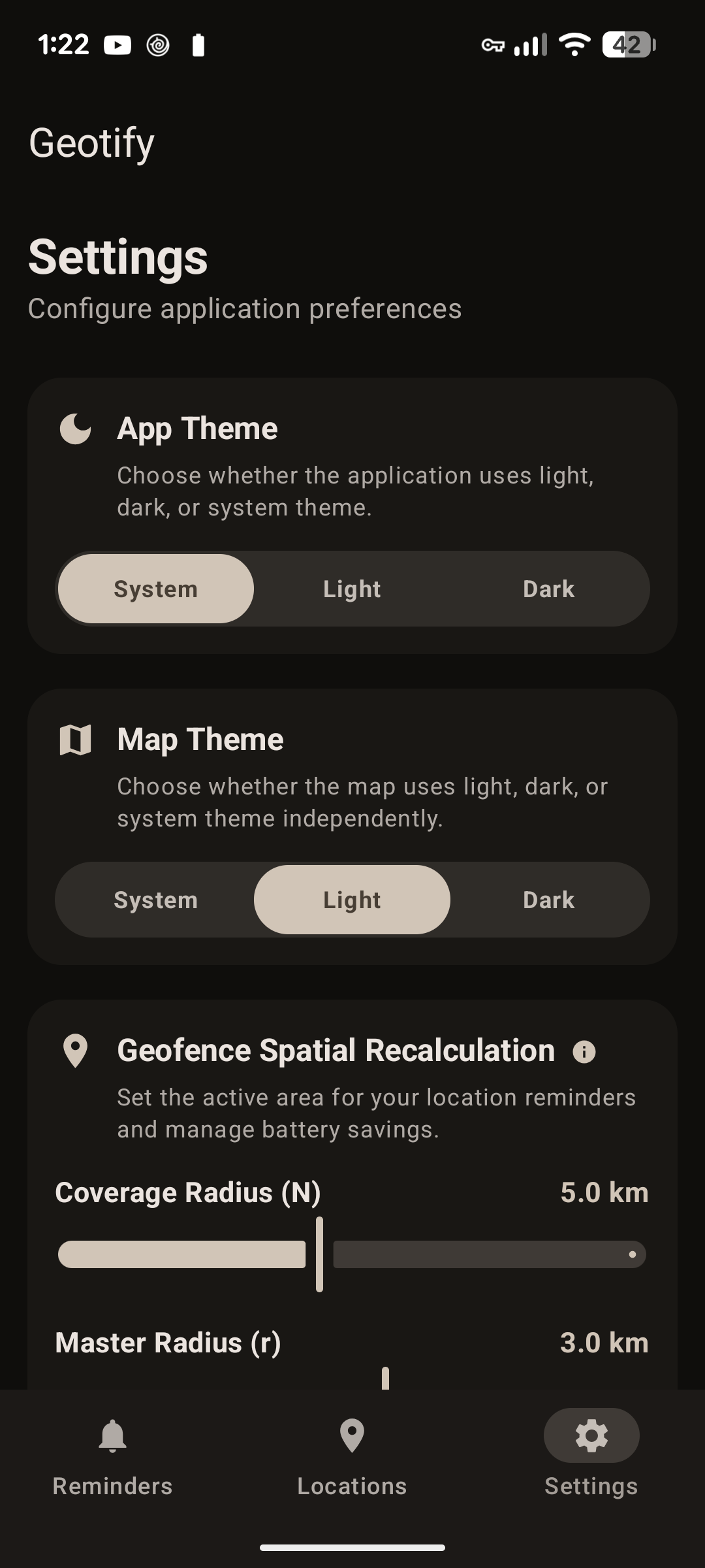 Preferences for themes and geofencing parameters. |
Independent Dual-Theme System
Geotify manages two independent theme flows via SettingsManager in DataStore:
- App UI Theme: Controls Material Design 3 color schemes for buttons, cards, and navigation bars (
SYSTEM,LIGHT,DARK). - Map Layer Theme: Controls OpenStreetMap tile rendering independently. This allows dark-mode app themes to maintain high-contrast light map tiles when outdoor sunlight readability is required.